
Building Footprint & Rooftop Extraction
Polygonal extraction of building perimeters, structural foundations, rooftop planes, and superstructures from high-resolution satellite, aerial orthophoto, and drone imagery.
Aerial and satellite imagery require annotation rules that respect scale, spatial context, terrain, land use, and image resolution. Josisoft builds geospatial annotation workflows around your map layers, class taxonomy, coordinate context, imagery source, and QA criteria so every feature is labeled consistently across tiles, regions, and large-area datasets.
Talk to a Data SpecialistPolygonal extraction of building perimeters, structural foundations, rooftop planes, and superstructures from high-resolution satellite, aerial orthophoto, and drone imagery.
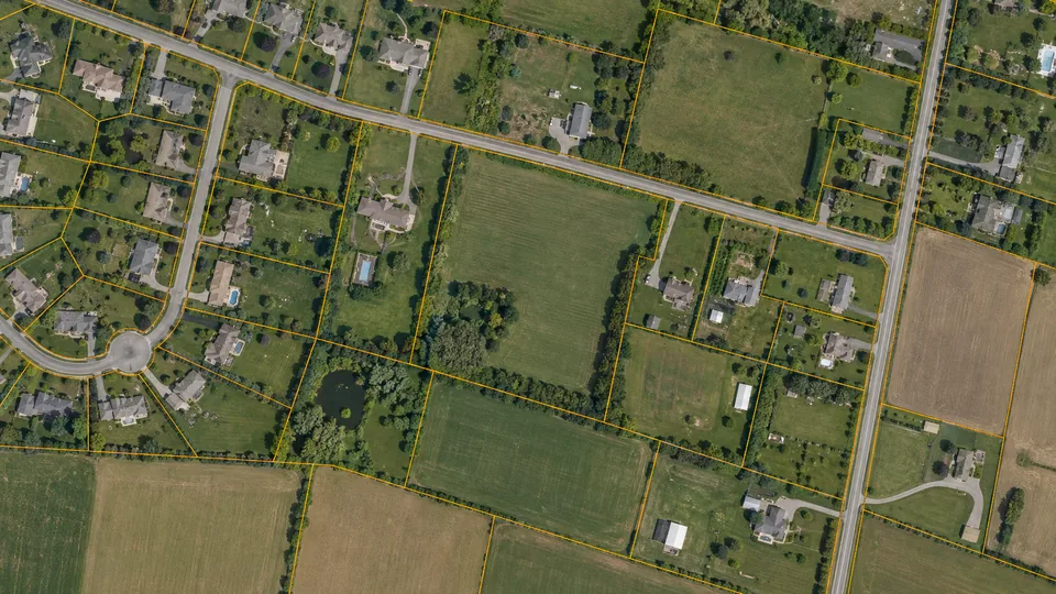
Legal property and tax parcel boundary digitization with strict topological enforcement: shared-edge snapping, zero-gap tolerances, and non-overlap boundary validation.
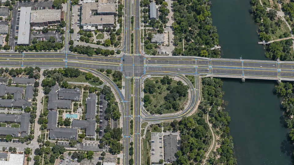
Extraction of road centerlines, multi-lane dividers, intersections, railways, pipelines, and bridge corridors structured as topologically connected routable network graphs.
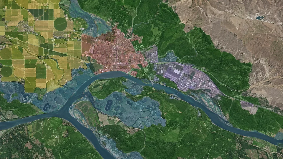
Dense, multi-tier semantic categorization of regional land cover across standardized classification schemes, mapping urban settlements, industrial zones, wetlands, barren terrain, and water bodies.
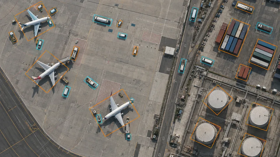
Rotated bounding box annotation (θ-angle alignment) for arbitrary-heading overhead targets, including maritime vessels, aircraft, ground vehicles, shipping containers, and storage tanks.
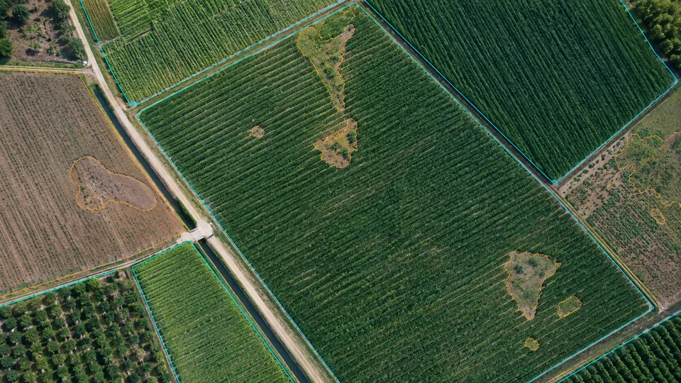
Vector delineation of farm boundaries, individual crop rows, planting zones, weed infestations, and bare-soil gaps across multi-spectral and RGB drone surveys.

Instance segmentation of individual tree crowns, canopy cover density, species classification, and biomass assessment for carbon credit verification and wildfire fuel modeling.
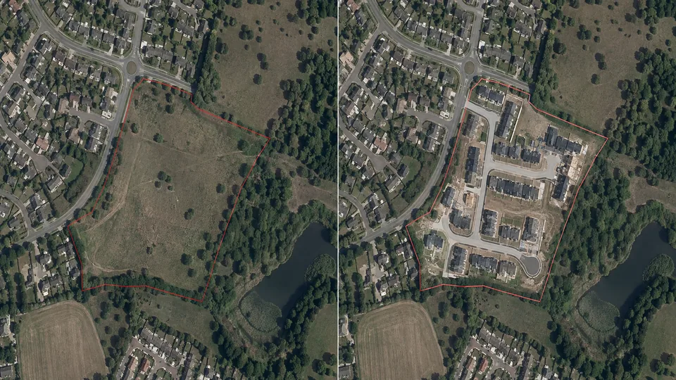
Pairwise time-series annotation across multi-date imagery (T1 vs. T2) to detect, quantify, and categorize urban development, unauthorized construction, deforestation, and infrastructure expansion.
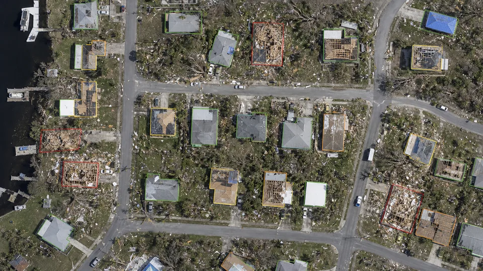
Post-catastrophe assessment annotating affected infrastructure and grading structural damage severity across standardized scales (e.g., xBD: undamaged, minor, major, destroyed) for emergency response and insurance underwriting.
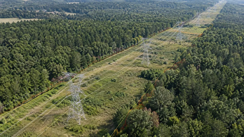
Asset extraction and clearance-zone measurement for high-voltage transmission lines, utility poles, pipeline right-of-ways, and hazardous vegetation encroachment corridors.

Delineation of solar photovoltaic (PV) arrays, individual panel modules, commercial rooftop installations, wind turbine coordinates, substations, and maintenance access routes.
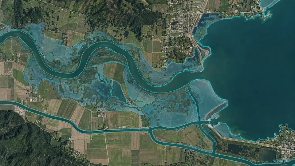
Extraction of natural and artificial water boundaries, including dynamic tidal shorelines, river centerlines, canal networks, reservoir perimeters, and flood inundation zones.
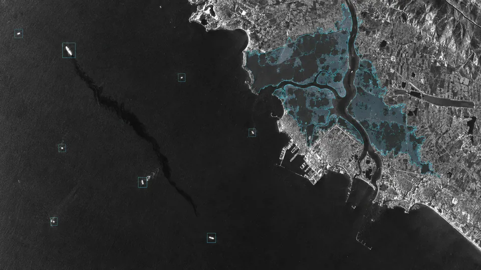
Feature extraction and target detection across single- and multi-polarized SAR imagery, isolating maritime dark vessels, oil spills, surface subsidence, and flood extents through cloud cover and night conditions.

Extraction of 3D geometric building volumes from stereo satellite pairs and aerial photogrammetry, generating LOD1 block extrusions and LOD2 pitched roof geometries for urban digital twins.
Our geospatial annotation teams can work inside client-approved labeling and mapping environments supporting polygons, segmentation, raster imagery, vector layers, and spatial review workflows, including tools such as CVAT, Label Studio, SuperAnnotate, Kili Technology, QGIS-based workflows, or other approved systems.
Annotators can operate within client-owned geospatial platforms through approved secure access, following your existing tile structure, coordinate conventions, class taxonomy, polygon rules, layer order, and review process.
When no production environment is available, we can configure controlled project workspaces around your imagery source, annotation classes, map layers, geometry rules, permissions, and QA stages for pilot and scaled delivery.
Field boundaries, crop segmentation, canopy mapping, weed detection, irrigation zones, soil regions, and land-condition labeling for agricultural imagery and remote-sensing datasets.
Building footprints, roads, parcels, land use, infrastructure, construction areas, and urban features for mapping, planning, and city-scale computer vision datasets.
Annotate solar panels, transmission corridors, pipelines, utility assets, access roads, substations, and surrounding land features from aerial or satellite imagery.
Identify vegetation, water bodies, flood extent, damaged structures, shoreline changes, burn areas, or client-defined environmental features in controlled remote-sensing workflows.
Every annotator, QA reviewer, and project manager signs an NDA before accessing project assets.
Personnel are trained on data confidentiality: strict restrictions on screen sharing, zero tolerance for screen recording or screenshots, and supervised session management.
On-premise operations at our central Durgapur facility enforce controlled local networks, restricted USB and removable media ports, and supervised work environments.
Each client is assigned a dedicated team working in siloed environments, preventing cross-project data contamination and maintaining domain context.
Share a representative imagery set, class taxonomy, map layers, boundary rules, and QA requirements with our delivery team. We will calibrate the spatial guidelines, annotate a controlled pilot area, review geometry and cross-tile edge cases, and return the sample for acceptance before production scaling.